Archaeological
Guidance notes
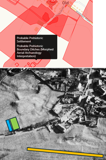
This section has been supported, amongst others, by Charlotte Walker of Northamptonshire HER and Andy Chapman, of Northampton Archaeology Society. Firstly, By clicking on the site below(Labelled 1), you will open up a map of Old & by hovering over the map, details will be highlighted regarding various archaeological items. An example of this is given within the picture to the left.
The next item (Label 2) shows an aerial picture, probably taken in circa 1960 . With regard to Aerial pictures and other HER elements there will be reference to “Hollow Way” The Hollow Way is an area that is represented in orange on the example picture to the left and is also called, in old English terminology, a “mire gutter” (or myre gutter) and is a drainage channel, ditch or small watercourse probably associated with the old spring in Chapel Lane.
Within descriptions below (Label 3) you will also note reference to “Toft”, “Croft” and “Linear Systems”. The Toft was the specific plot of land where the peasant’s house, outbuildings, and farmyard was built. A typical example of this is shown in blue on the adjacent picture. The “Croft” was the long, narrow strip of land directly behind the toft and is shown in light green. Lastly, a linear settlement is a village layout where houses and plots are arranged in a long straight. This can be seen in the Aerial Picture below.
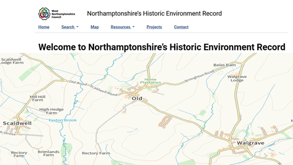
This page has been kindly given by Northamptonshire Archives and Heritage Service and shows details with regard to the area around Old. Click on left, or this narrative to open the map and then hover over the red areas to see a description of what the map is referring to.
Full details of this site, including copyright details, can be viewed here
1.
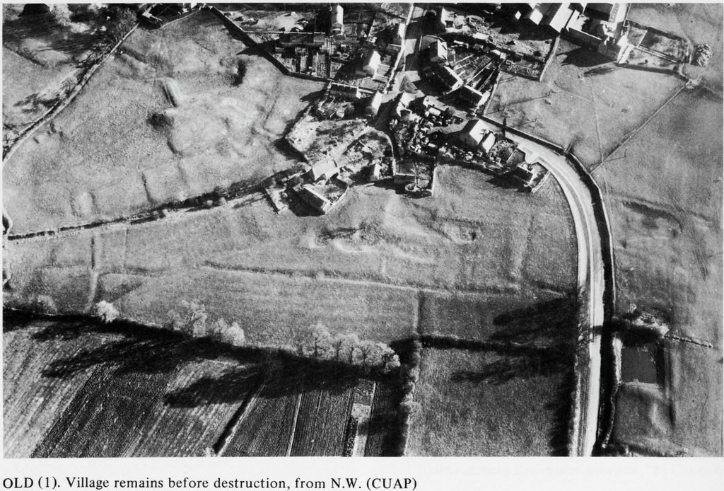
Note from Andy Chapman:- To the left (on the photo) there is a slightly curving row of quite well-defined rectangular house plots, and on the opposite side of the hollow way, marked by a hedge line, there are faint remnants of a probable facing row of house plots. At the top right of the upper row, heading towards the houses, there may be a side branch of smaller house plots. The area to the right is interesting but difficult to interpret. There is a very clear L-shaped ditch system. Between this and the houses there are areas of quarrying disturbance, but these generally follow rectangular forms, and I wonder whether this might have been perhaps three buildings, a manor house complex perhaps, that had been not merely levelled, but very thoroughly robbed into the foundations. But that is speculation, To the right, below the linear ditch, you can see the parallel furrows of the medieval field system. To the left (on the photo) there is a slightly curving row of quite well-defined rectangular house plots, and on the opposite side of the hollow way, marked by a hedge line, there are faint remnants of a probable facing row of house plots. At the top right of the upper row, heading towards the houses, there may be a side branch of smaller house plots. The area to the right is interesting but difficult to interpret. There is a very clear L-shaped ditch system. Between this and the houses there are areas of quarrying disturbance, but these generally follow rectangular forms, and I wonder whether this might have been perhaps three buildings, a manor house complex perhaps, that had been not merely levelled, but very thoroughly robbed into the foundations. But that is speculation, To the right, below the linear ditch, you can see the parallel furrows of the medieval field system.
2.
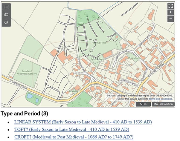
This note refers to the upper and adjacent picture:- Earthworks lying north-west of the present village. Most of the site has been destroyed by modern development and levelling of a playing field. The remains comprise a broad hollow way running northwards in a sweeping curve from an existing lane in the village towards the stream. On either side of the hollow way were several embanked closes, presumably the sites of former houses and their gardens. To the east of the hollow way was a large, deep and roughly rectangular pond, with a massive bank or dam at its northern, lower end. South-east of the pond were other embanked closes and hollow ways. To the south-west of the main hollow way were a series of ill-defined paddocks, bounded by shallow ditches and low banks. These still survive but have been damaged by old quarry pits.
References :- Royal Commission on The Historical Monuments of England, 1979, An Inventory of The Historical Monuments in The County of Northampton, p.116 Site 1 (checked) (Series). SNN77380.Northamptonshire SMR Collection of Aerial Photographs, Used with NMR & CUCAP collections (Aerial Photograph(s)). SNN104822.Sources/Archives (2) SNN104822 Aerial Photograph(s): Northamptonshire SMR Collection of Aerial Photographs. Used with NMR & CUCAP collections.BCSNN77380 Series: Royal Commission on The Historical Monuments of England. 1979. An Inventory of The Historical Monuments in The County of Northampton. 2. HMSO. p.116 Site 1
3.
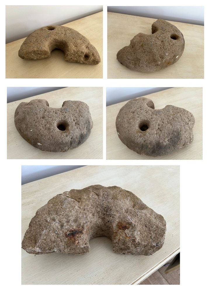
Quernstones found in or near the village Old. The quernstone opposite was found in a garden wall at a property in the village in the late 1970’s. It was shown to Northampton Museum at that time and their view then was that it was “probably of Roman origin and of stone possibly originating either Germany or Belgium.
As at October 2026, the latest opinion (of Andy Chapman) is as follows :- “While an Iron Age date cannot be totally excluded, the small size of the stone, c.300mm, and the recovery of it from a stone wall, suggest that it is more likely to have been in use in the post-medieval period, 16th -18th centuries, and became disused and later abandoned when modern processing made such things redundant. The small diameter may indicate that it was the grinding stone from a pot quern, with a small grinding/upper stone rotating within a bowl-shaped lower stone. I will be sending you a copy of a short paper on Rotary Querns c.700-1700, which includes a section on post-medieval querns with an illustration of a pot quern. These could be used for grinding grain, but at this date they were most often used for grinding malted grain for brewing ale, or mustard grains. Through the medieval period brewing ale was the preserve of women, the alewives, but they had been largely driven out of the trade by 1600, as it came under the control of established Guilds. The production of bottles was growing through the 17th century and there is a reference in 1691 that bottled beer kept longer than beer in barrels. But industrial scale production of beer only began in the second half of the 18th century, with improved steam engines. So it is likely that the use of hand mills to produce ground malt for small-batch brewing at home would have been in decline through the 18th century. This might suggest that the quern was abandoned and ended up in a stone wall perhaps somewhere between c.1650-1800, as the availability of bottled beer increased and home production was abandoned. Of course, a similar argument would apply to either grinding grain or mustard, as the industrial revolution also made these more readily available to buy ready processed.”
4.